Waterfalls were flowing towards the sky. As for the sky, it seemed to darken as the sun rose higher. Trees clinging to the cliffs grew in swirls and bursts of green; The tropism that guided them was inconsistent. The storms were tossing here and there a large flock of vultures, and even the lone albatross was struggling to soar and soar. He was alone for a reason; vultures ate her chicks.
Our little boat seemed to be turning, sometimes going backwards, as it struggled to find a course across the stormy, wave-tossed Admiralty Sound.
“When is it quietest here?” I asked the captain, who had just closed the outer door.
“Winter,” he said.
It made sense that everything would fall apart in Tierra del Fuego. Separated from the South American mainland by the Strait of Magellan, this island was once believed to be connected to Antarctica, Terra Incognita, the mysterious beyond. In 1520, a Portuguese sailor discovered the strait while circumnavigating it and christened the southern coast the “Land of Fire” after seeing native Yamana lighting fires on the shores and in their canoes.

Today, the island is sold to tourists as “Fin del Mundo”, meaning the end of the world. There is a nice irony here; During the hottest days of the Cold War, the southern tip of South America was seen as a safe haven. Bruce Chatwin reflects on this in his 1977 travelogue in Patagonia: “The war was going to come to the Northern Hemisphere, so we looked to the South. We eliminated the Pacific islands because islands are traps. “We eliminated Australia and New Zealand and identified Patagonia as the safest place on Earth.”
As rumors of apocalypse resurface, we inevitably wonder where the bombs will fall. Hypothetical maps show Europe more or less destroyed. Only Latin America and Africa are outside the zone of nuclear weapons holders, hosts and allies. Argentina and Chile are avoiding predicted starvation due to nuclear winter.
Why would someone bomb Tierra del Fuego? Settlements established to raise sheep for export of wool and to provide meat for the ships round Cape Horn are inadequate. Ships were docking at Punta Arenas, where my visit began. The once important port is now filled with maritime memorabilia and replicas of old ships. The Panama Canal killed traffic.
I passed over the First Narrows of the Strait to Tierra del Fuego; Even in the presence of road-weary truckers, this seemed like an important ceremony. It was early morning, and a low sun was beating down on the shadowy plains; For the rest of the day the sun would struggle to burn through the low, gray clouds.
My first stop, Cerro Sombrero, was a bit apocalyptic. Oil was discovered nearby in 1945, and the town – its name means “Hat Hill” after a nearby outcrop in the otherwise flat moorland – was built to house the shipowners’ families. Approximately 680 people live there today, and while the banners claim that the mass housing project won awards in the field of architecture, I believe these were awarded half a century ago. The cinema, social club, supermarket and small bungalows looked like a mixture of Soviet-era brutality and municipal-estate functionality.

Sixty miles down the road there was a more surprising discovery: South America’s only king penguin nest, in Bahía Inútil (Useless Bay). It is a private reserve, receives zero support from the national or state government, and is managed by the Fernández family. Daughter Aurora explained the importance of this area: “There are hundreds of thousands of king penguins in South Georgia, and we only have a few – but we started with seven [in 2011] and currently they number around 140. “After staying in the Bosphorus for a long time, they now come to nest every year.”
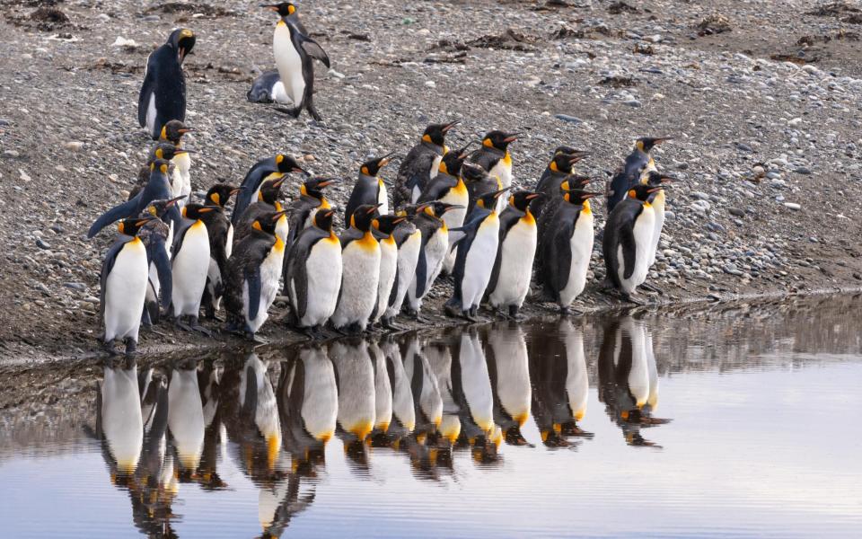
Aurora said she also saw rock hoppers, skuas and leopard seals, which are typically associated with Antarctica. Tierra del Fuego was also starting to look like a haven for nature.
A little further down the road I saw the “Draga Aurifera” – “Golden Shovel” sign, a relic of the island’s brief gold rush period. In 1885, a Romanian bandit named Julius Popper arrived in Tierra del Fuego, started a mining operation, and within a few years raised a private army to lay claim to a large swath of the region, decimating the indigenous population in doing so.

Newspapers in Buenos Aires exaggerated the “gold rush”, attracting large numbers of people from central Argentina and Chile, as well as foreign immigrants, especially Dalmatians. It turned out that there was a limited amount of gold, but the false influx led to the establishment of the first towns inland.
This is the risk in remote places: they are safe in the sense that they are far from common sight and reason. But they also attract tin despots and scammers.
South of here was nature; wild, raw and beautiful. There were miles of gently rolling steppe populated only by the guanaco, the red-furred relative of the llama.
Suddenly, a series of dramatic flashbacks whisked me away to a viewpoint overlooking the Darwin Range, where the mighty Andes bend eastward before plunging into the ocean. More daunting than beautiful, the steep upper reaches of the 6,000 ft peaks were almost entirely drowned by glaciers; You don’t need to go high to reach extreme topographies and temperatures at this latitude.
At their feet were the freshwater Lake Fagnano and the saltwater Admiralty Sound; Glaciation had formed on both, and only a narrow strip of land separated the two large bodies of water. Apart from a few strips of gravel roads, there was almost no sign of human habitation; Much of the area is now part of Yendegaia National Park or Karukinka Natural Park, conservation projects sponsored by US philanthropic organizations. Rewilding plans have spread to Argentina and Chile. Compared to Europe and even North America, these are a real paradise.
I stayed in a wooden cabin in Fagnano for three nights. I couldn’t go canoeing on the Sound – the wind was too strong, turning the water into a terrible foam – but I did take some lovely lakeside walks through forests of coihue and lenga, hardy southern beeches that can withstand high winds. winters. I was impressed by the crimson and gold leaf cover; When I came to the south, it was early autumn. On my last night, I enjoyed asado (barbecue) and felt like a survivalist or forester. I could have happily stayed there a while longer.

Admiralty Sound was visited by Charles Darwin in 1831. This must have truly felt like the end of the world for the young naturalist; but the striking lichens and mosses covering the rocks could undoubtedly distract him from any contrary thoughts.
My journey ended in the Beagle Channel. After a morning hauling southern king crabs for lunch, I spent some time wandering around Ushuaia, the “southernmost city in South America,” and therefore the world. With its museums, restaurants and hotels, Ushuaia is an end-of-the-world destination, elite to serve cruise passengers who board here to go to the Falklands and Antarctica. That’s all most people see in Tierra del Fuego, and I must say they’re missing out: this vast, empty edge meets all the needs of adventurers.
how to
Swoop has a special seven-day Journey to the End of the World tour around Tierra del Fuego, visiting Punta Arenas, Lake Fagnano, remote lodges and estancias, gold rush towns, and a king penguin colony. Prices start from £4,000 per person including accommodation, meals, guides and road travel. Extra flights: Budget £1,000 for a return journey from the UK to Punta Arenas with Latam.
Where else can you escape from the apocalypse?
Australia and New Zealand
According to a study published in the journal Risk Analysis, these two countries are among the countries that can produce enough food for their own populations after the “disaster-mitigating effect of sudden sunlight” such as a nuclear war, super volcano or asteroid impact. Iceland, Solomon Islands and Vanuatu were also named smart choices.
south dakota
You might think that the United States is a place to avoid on doomsday. But California-based extinction shelter company Vivos is selling 575 “military-built, concrete-and-steel, all-risk shelters” in the Black Hills south of the city of Edgemont. At $55,000 (£43,377), they’re cheaper than a Manhattan bin.
Greenland
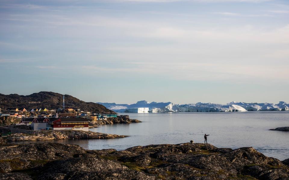
The 56,000 inhabitants of this giant island live in small settlements scattered along the coast, and according to a blogger who calls themselves The Smart Survivalist, Greenland “has very few military objectives,” making it a logical option. “There are no major cities or industrial facilities on the island, making it less attractive as a target for nuclear attack,” he says, but much of the island is “covered by a sheet of ice, which means there will probably be very little damage.” Remember, adapting to life on the ice sheet can be difficult.
Ireland

Who knew? A ferry from Fishguard might be worth more than an underground silo inside a South Pacific volcano. According to researchers from Anglia Ruskin University, Ireland is among the countries “best suited to maintain higher levels of social, technological and organizational complexity within its borders in the event of a global collapse.” New Zealand, Iceland, Tasmania and, wait for it, the United Kingdom were among other countries best placed to recover from a global megashock.